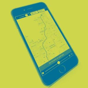
 Building on the success of MacMap for the iPhone launched 2 years ago, Esri Canada, the School of Earth, Environment & Society and RHPCS bring you MacMap 2.0, developed using ArcGIS for iOS. Using the interactive map you’ll be able to calculate the shortest walking path between building entrances. The app also allows filtering of accessible entrances for your route. Map layers include:
- Esri Canada’s Community Basemap
- HSR Bus Stops
- Emergency Phone Locations (Red Diamonds)
This app will be updated on a regular basis to reflect changes to the campus. Coming soon, full 3-D buildings and navigation as well as the ability to navigate to the different classrooms within buildings on campus.
Partners Involved In The App:
- Software development by Esri Canada
- Data provided by Dr. Darren Scott and Patrick DeLuca from the School of Earth, Environment & Society
- Service is hosted by Research & High Performance Computing Support
For more information, please email Patrick DeLuca